Get more on OKRs with code
Copied!

Get more on OKRs with code
Copied!

VPS: How to Teach Users New Tech
VPS: How to Teach Users New Tech
VPS: How to Teach Users New Tech


Helping to build the company's map of the world
Helping to build the company's map of the world
Unlike traditional 2D maps, Niantic wants to create a 3D map of the world. To do so, it requires lots of scanning and mesh data of many locations around the world. I led the design for a mobile app to help surveyors scan locations, upload data, test VPS, and slowly build the company's map of the world. In working towards this goal, I collaborated with both internal teammates (Product Managers, Engineers, Operations) and external teams (Other Product Teams, R&D) to determine the product's requirements and features. This app is part of the company's developer platform, Lightship. For more info about how VPS connects to Lightship, click on the button below.
Unlike traditional 2D maps, Niantic wants to create a 3D map of the world. To do so, it requires lots of scanning and mesh data of many locations around the world. I led the design for a mobile app to help surveyors scan locations, upload data, test VPS, and slowly build the company's map of the world. In working towards this goal, I collaborated with both internal teammates (Product Managers, Engineers, Operations) and external teams (Other Product Teams, R&D) to determine the product's requirements and features. This app is part of the company's developer platform, Lightship. For more info about how VPS connects to Lightship, click on the button below.
Client
Client
Niantic
Niantic
Timeline
Timeline
18 months
18 months






VPS: The New Way to Navigate
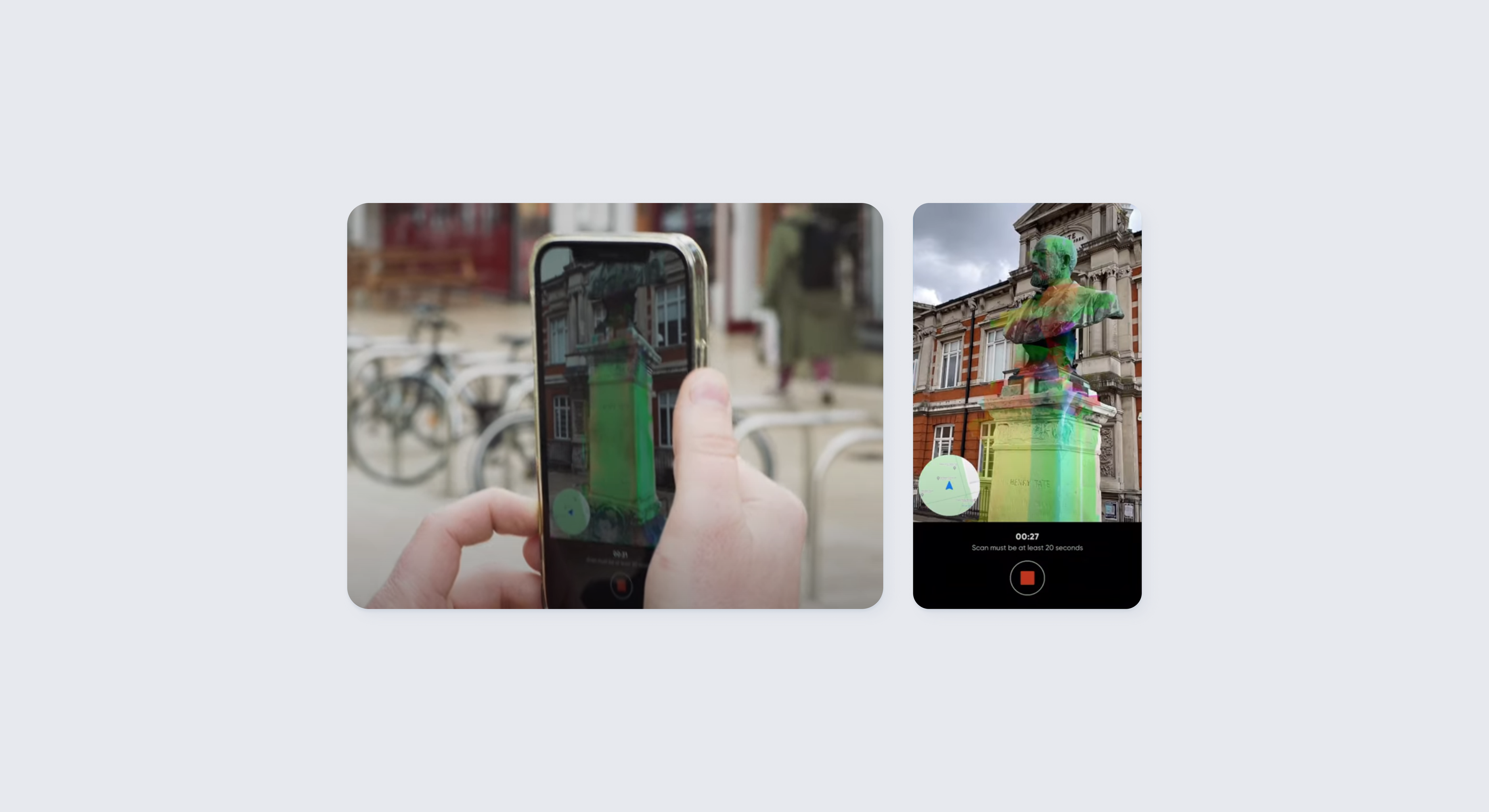
The biggest advantage of a 3D map of the world is the Visual Positioning System (VPS). Compared to GPS which uses coordinates and points to determine a person's location, VPS uses the visual surroundings to determine location. This feature is unique to 3D maps, but requires lots of mesh data to support.
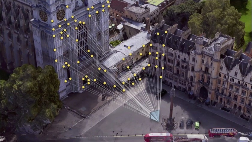
Enabling VPS requires many datapoints about a location.
VPS: The New Way to Navigate
The biggest advantage of a 3D map of the world is the Visual Positioning System (VPS). Compared to GPS which uses coordinates and points to determine a person's location, VPS uses the visual surroundings to determine location. This feature is unique to 3D maps, but requires lots of mesh data to support.

Enabling VPS requires many datapoints about a location.
VPS: The New Way to Navigate
The biggest advantage of a 3D map of the world is the Visual Positioning System (VPS). Compared to GPS which uses coordinates and points to determine a person's location, VPS uses the visual surroundings to determine location. This feature is unique to 3D maps, but requires lots of mesh data to support.

Enabling VPS requires many datapoints about a location.
Building an App for Surveyors
To achieve the goal of a 3D map, the company hired contracted surveyors to scan and generate 3D meshes of locations. To further aid in this goal, a mobile app was planned for development, enabling anyone to scan with their smartphone, instead of a proprietary, expensive device.
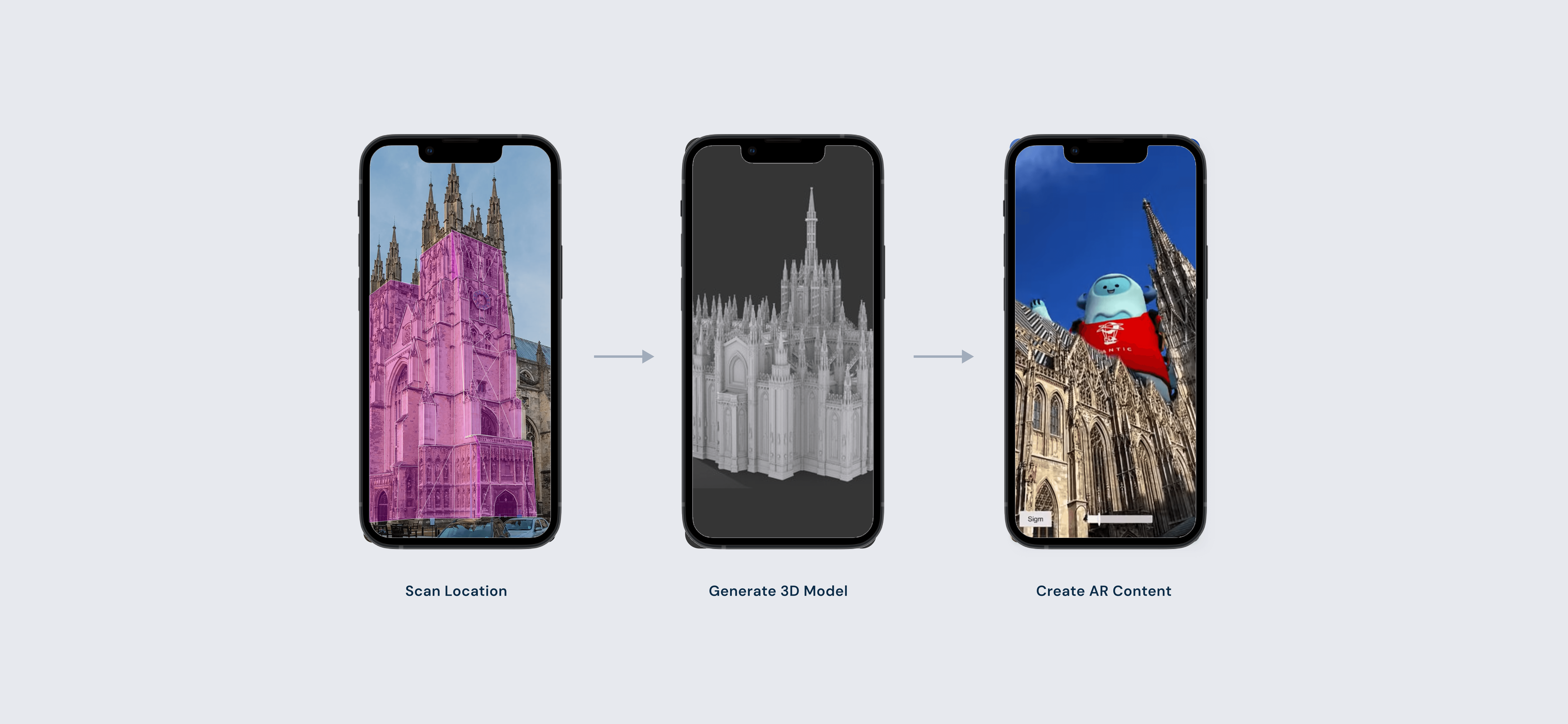
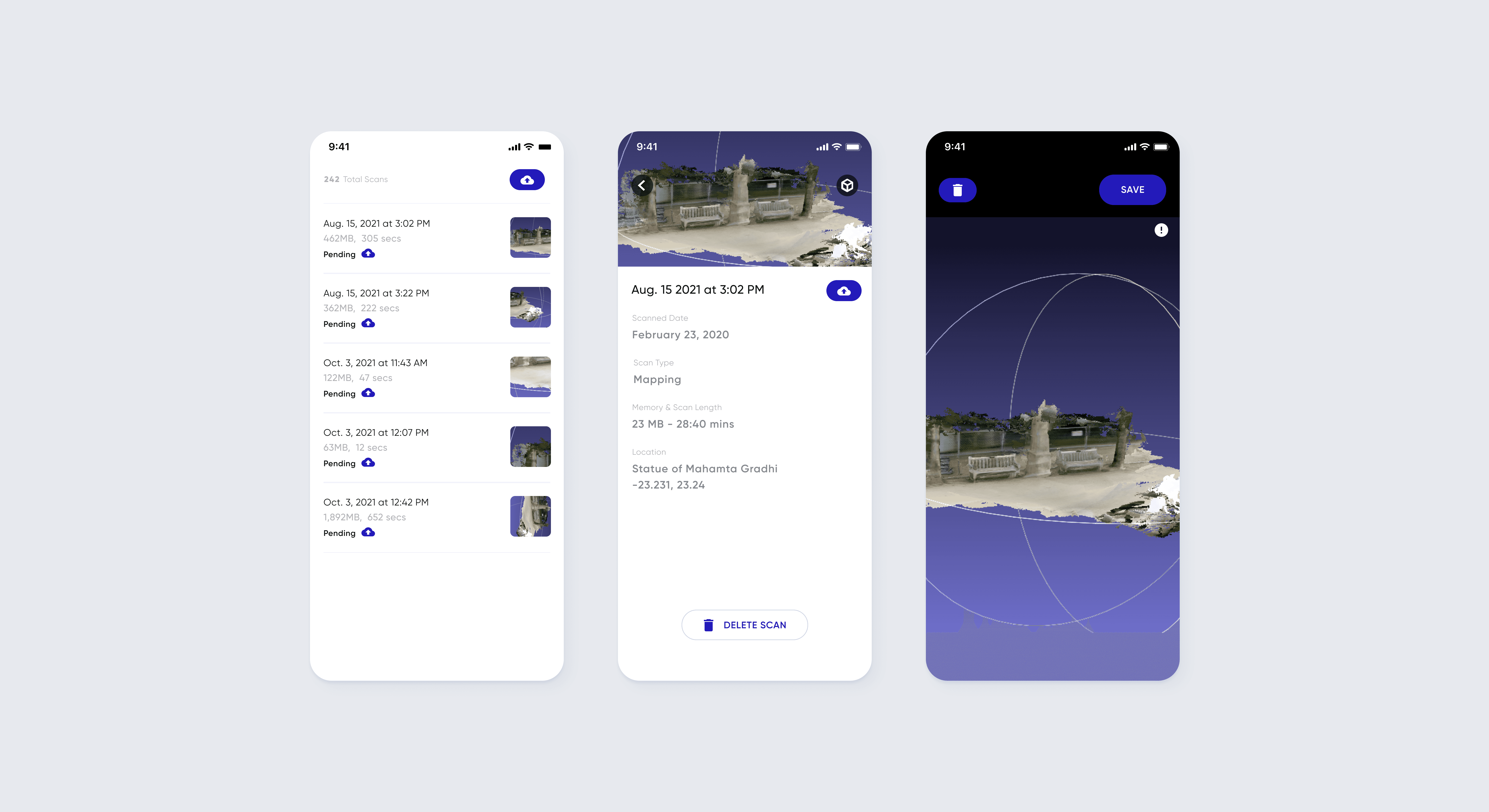
From scanning a location to generating a mesh to using the mesh, this is the general flow of development.
Building an App for Surveyors
To achieve the goal of a 3D map, the company hired contracted surveyors to scan and generate 3D meshes of locations. To further aid in this goal, a mobile app was planned for development, enabling anyone to scan with their smartphone, instead of a proprietary, expensive device.

From scanning a location to generating a mesh to using the mesh, this is the general flow of development.
Building an App for Surveyors
To achieve the goal of a 3D map, the company hired contracted surveyors to scan and generate 3D meshes of locations. To further aid in this goal, a mobile app was planned for development, enabling anyone to scan with their smartphone, instead of a proprietary, expensive device.

From scanning a location to generating a mesh to using the mesh, this is the general flow of development.


Determining the Based Features
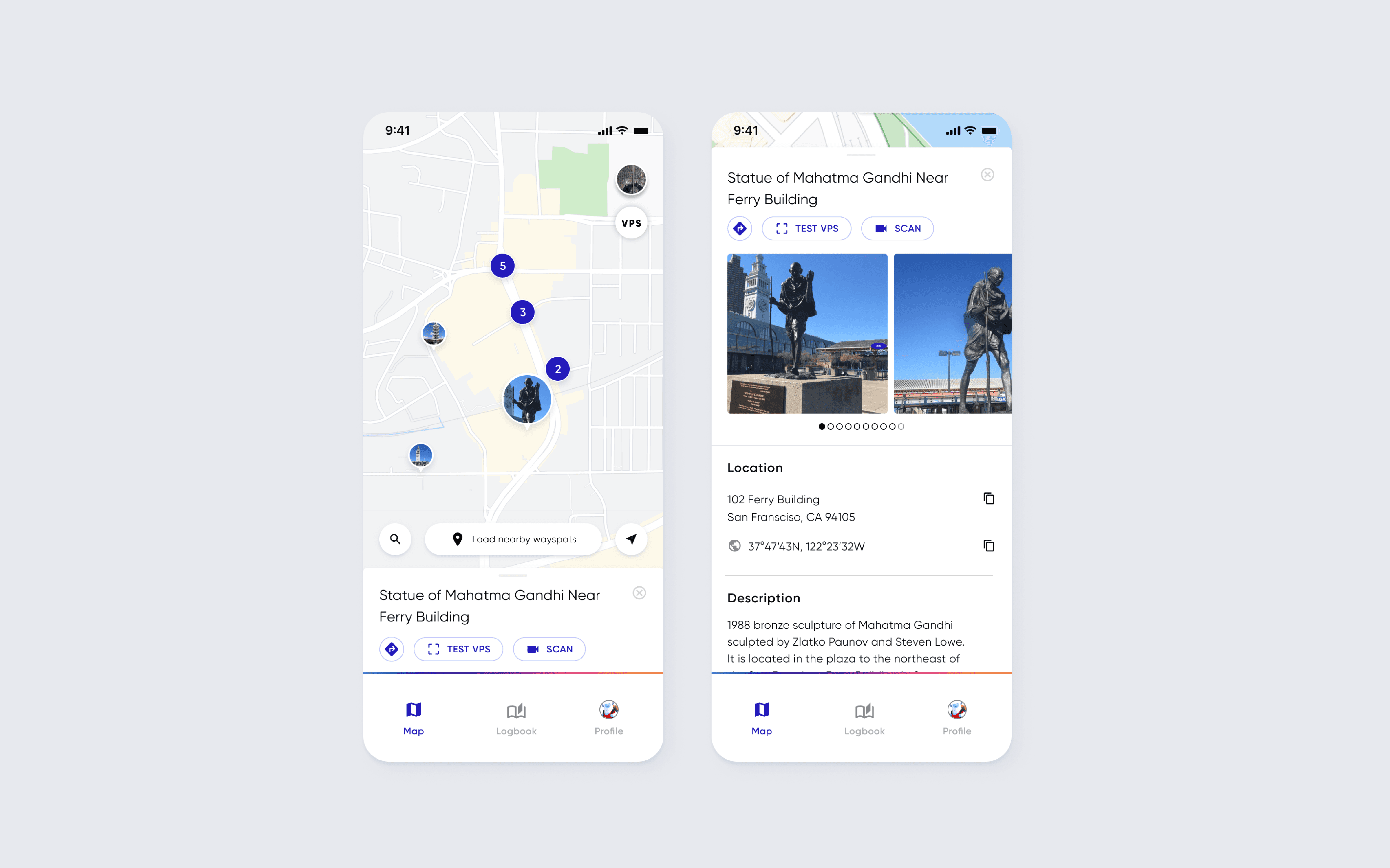
I partnered with Operations, who are in charge of managing surveyors, in determining requirements needed for this app. After much discussion, I determined the required features needed.
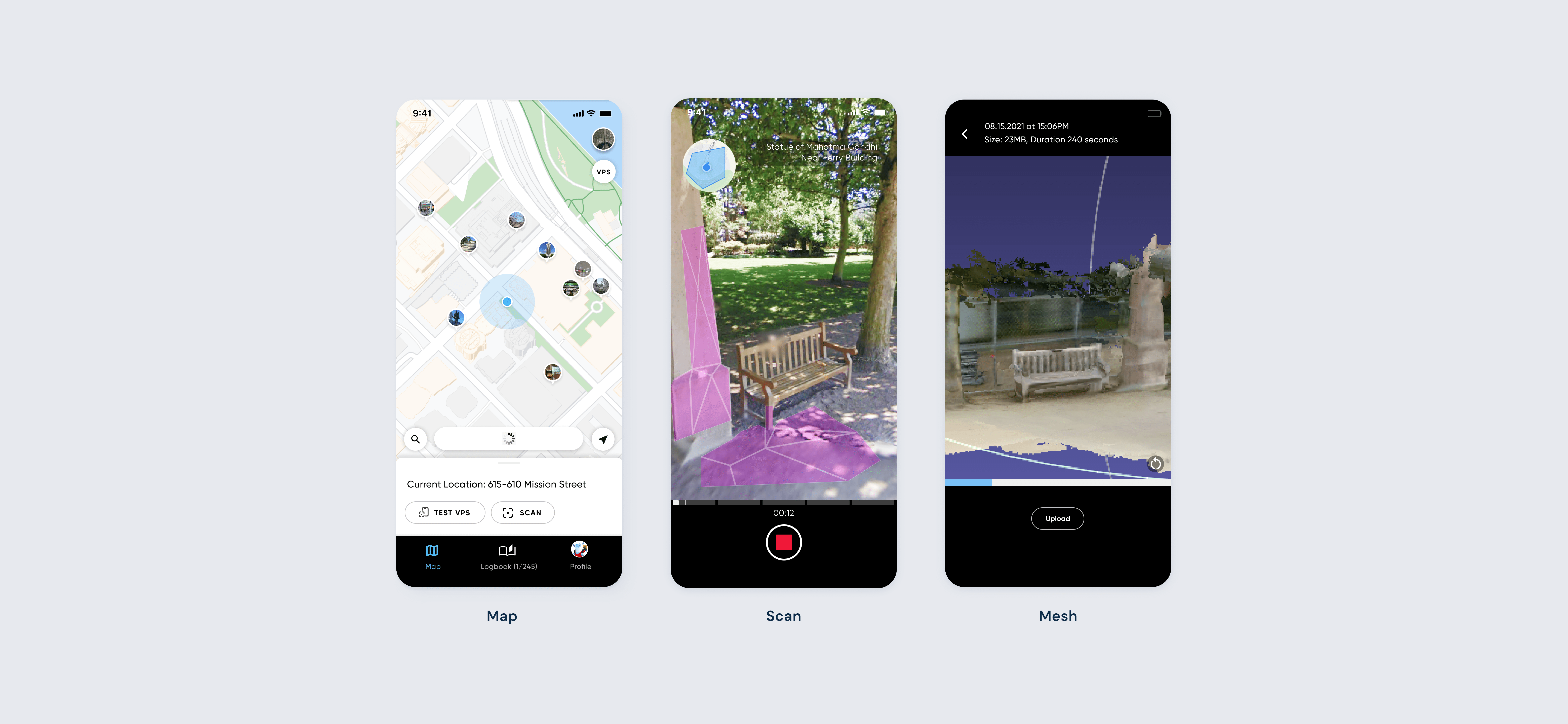
The three main features: Map, Scan, and Mesh
Determining the Based Features
I partnered with Operations, who are in charge of managing surveyors, in determining requirements needed for this app. After much discussion, I determined the required features needed.

The three main features: Map, Scan, and Mesh
Determining the Based Features
I partnered with Operations, who are in charge of managing surveyors, in determining requirements needed for this app. After much discussion, I determined the required features needed.

The three main features: Map, Scan, and Mesh
Determining the UI Best Practices
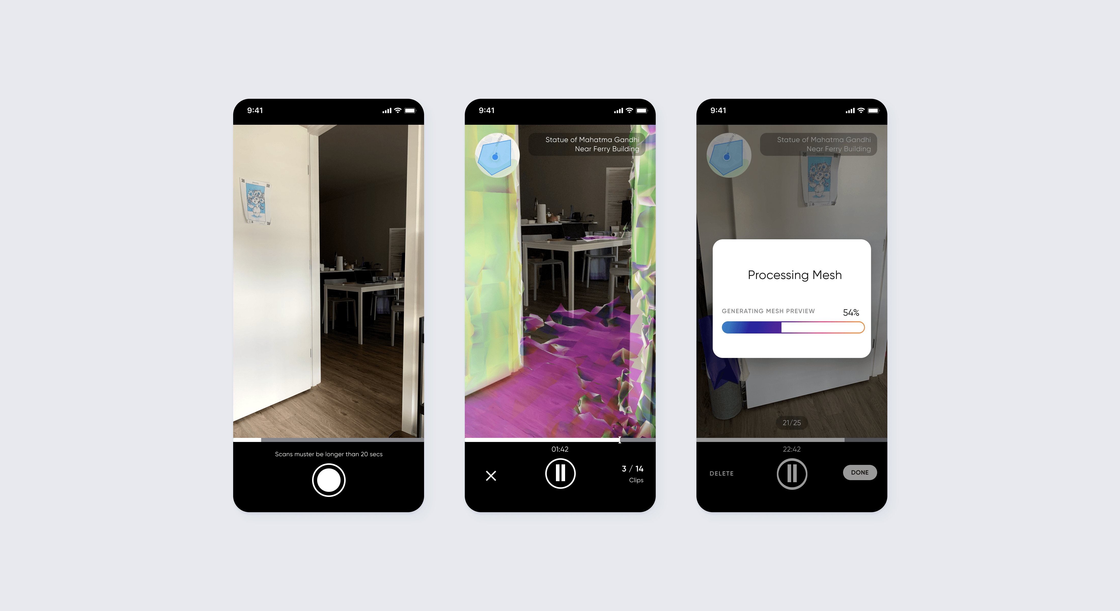
In terms of best practices, the AR space is still young and developing. With a niche feature such as scanning an object or a location, there was little convention on the best UI. For this project, I interviewed other AR designers, brainstormed new conventions, and experimented with new ideas for the best experience in the app.
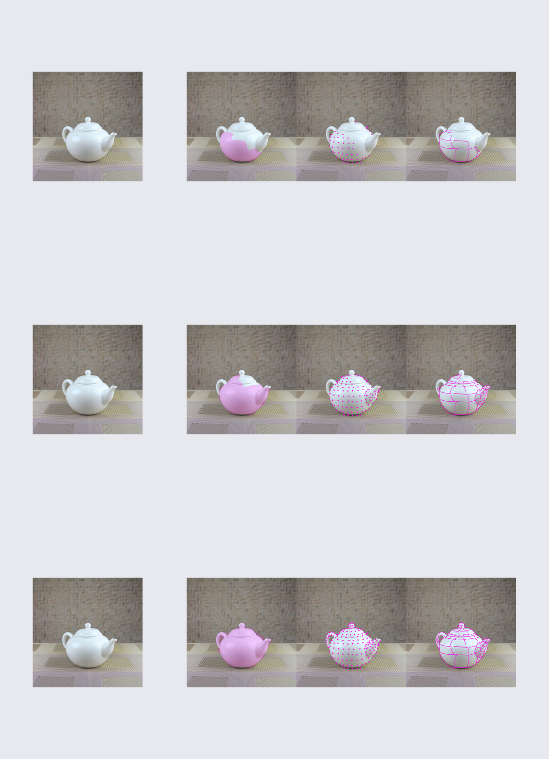
Rough GIFs showcasing three potential scanning UI to users.
Determining the UI Best Practices
In terms of best practices, the AR space is still young and developing. With a niche feature such as scanning an object or a location, there was little convention on the best UI. For this project, I interviewed other AR designers, brainstormed new conventions, and experimented with new ideas for the best experience in the app.

Rough GIFs showcasing three potential scanning UI to users.
Determining the UI Best Practices
In terms of best practices, the AR space is still young and developing. With a niche feature such as scanning an object or a location, there was little convention on the best UI. For this project, I interviewed other AR designers, brainstormed new conventions, and experimented with new ideas for the best experience in the app.

Rough GIFs showcasing three potential scanning UI to users.
Testing, Testing, and Testing
Before handoff to engineering can happen, I tested with people to determine if it was the best design. With the criteria being can the user 1.) differentiate between scanned and non-scanned areas, 2.) have awareness of surroundings, and 3.) quickly learn how to scan.
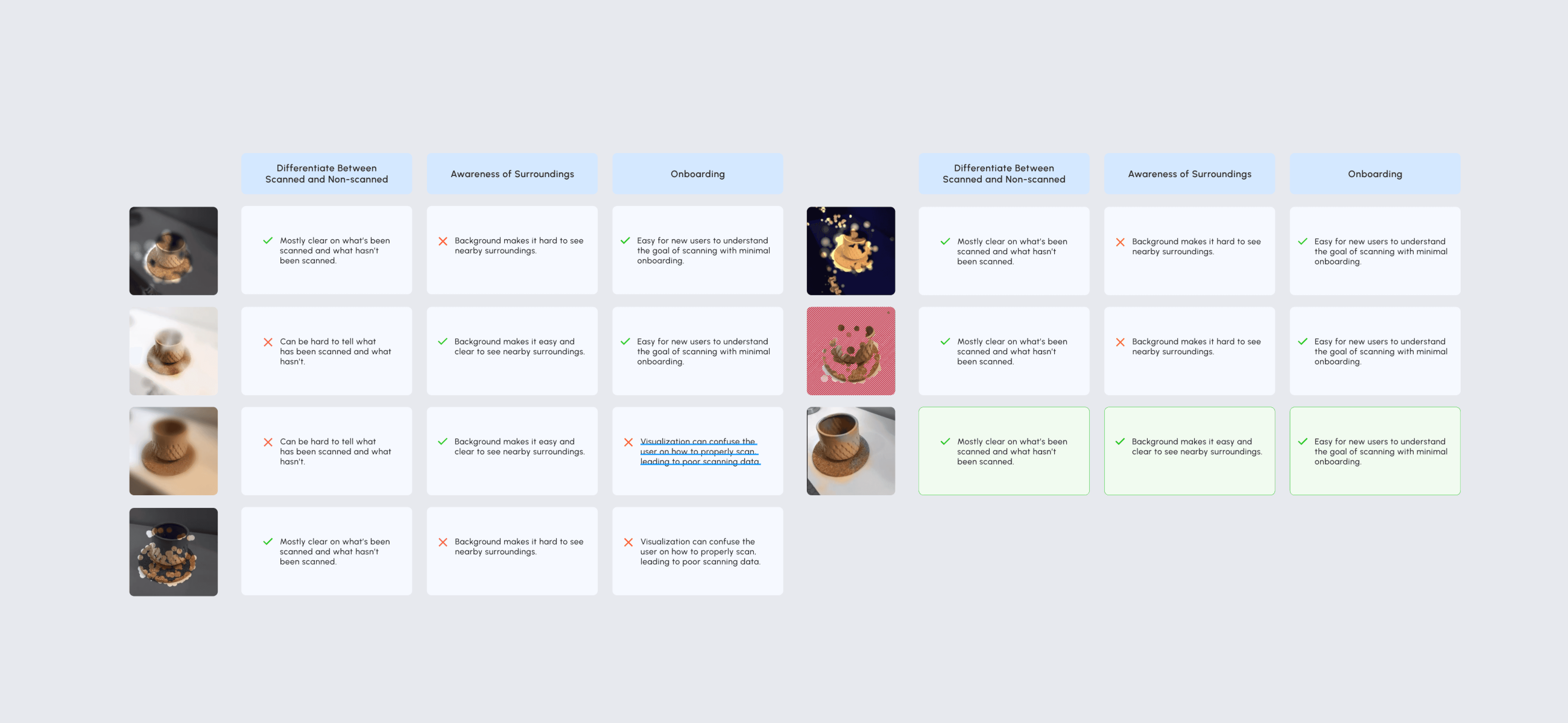
Results of user testing for different scanning UI.
Testing, Testing, and Testing
Before handoff to engineering can happen, I tested with people to determine if it was the best design. With the criteria being can the user 1.) differentiate between scanned and non-scanned areas, 2.) have awareness of surroundings, and 3.) quickly learn how to scan.

Results of user testing for different scanning UI.
Testing, Testing, and Testing
Before handoff to engineering can happen, I tested with people to determine if it was the best design. With the criteria being can the user 1.) differentiate between scanned and non-scanned areas, 2.) have awareness of surroundings, and 3.) quickly learn how to scan.

Results of user testing for different scanning UI.
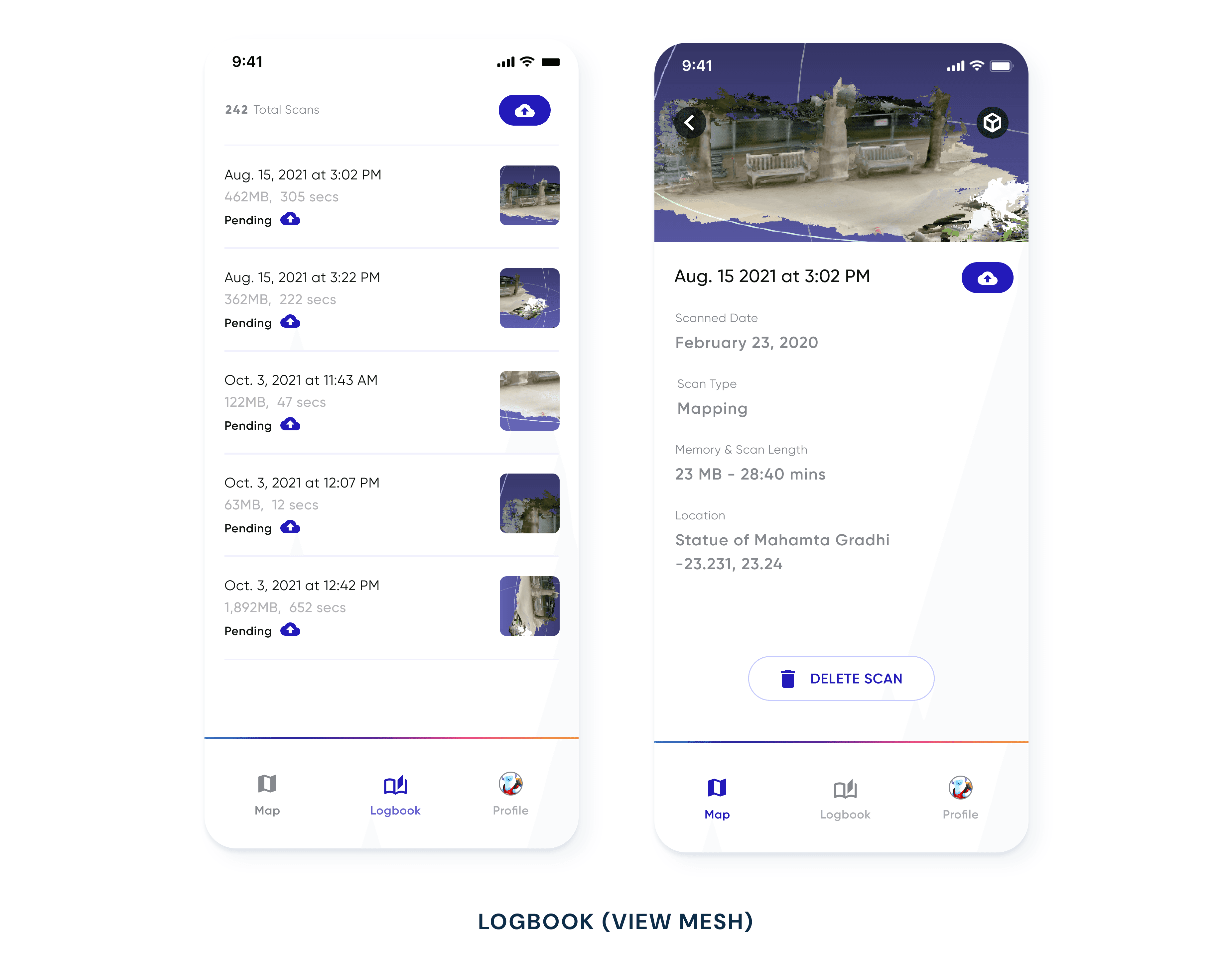
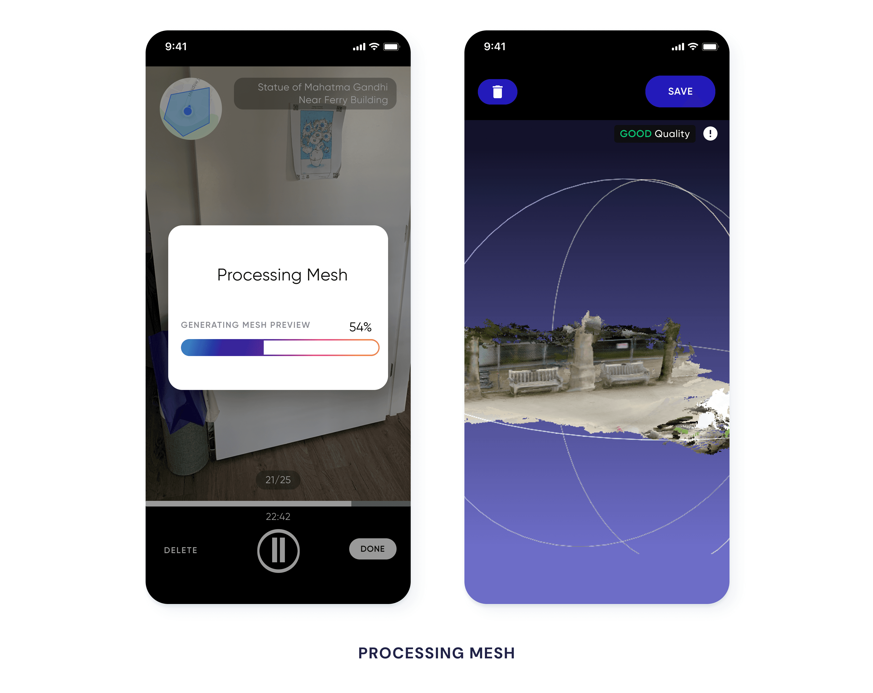
Putting it Together






Press
Introducing Lightship VPS
